
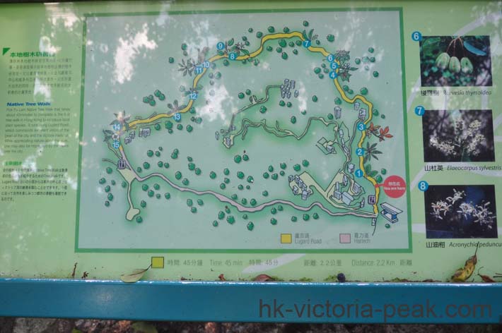
About this image: This is a detailed trail map of the Lugard Road and Harlech Road circular walk on Hong Kong's Victoria Peak, illustrating a lush, forested path winding through subtropical greenery with scenic viewpoints overlooking the city's skyline. The map highlights key landmarks like the Peak Tower and Reservoir, using yellow lines for the 2.3 km loop estimated at 45 minutes, with bilingual labels in English and Chinese reflecting the area's blend of nature and urban accessibility. Surrounding text provides practical information on distances, times, and local flora, inviting hikers to explore this iconic elevated promenade known for its breathtaking harbor panoramas.